Sea Of Trees: What "Jukai" Means And Why Aokigahara Got Its Name
Jukai (樹海) is two characters doing very literal work: 樹 means tree, 海 means sea. Put together, it reads as "sea of trees," and unlike a lot of place names that stretch a metaphor thin, this one holds up when you actually look at the forest from above. The reason it holds up is geology, not poetry, and it's worth understanding both halves of that.
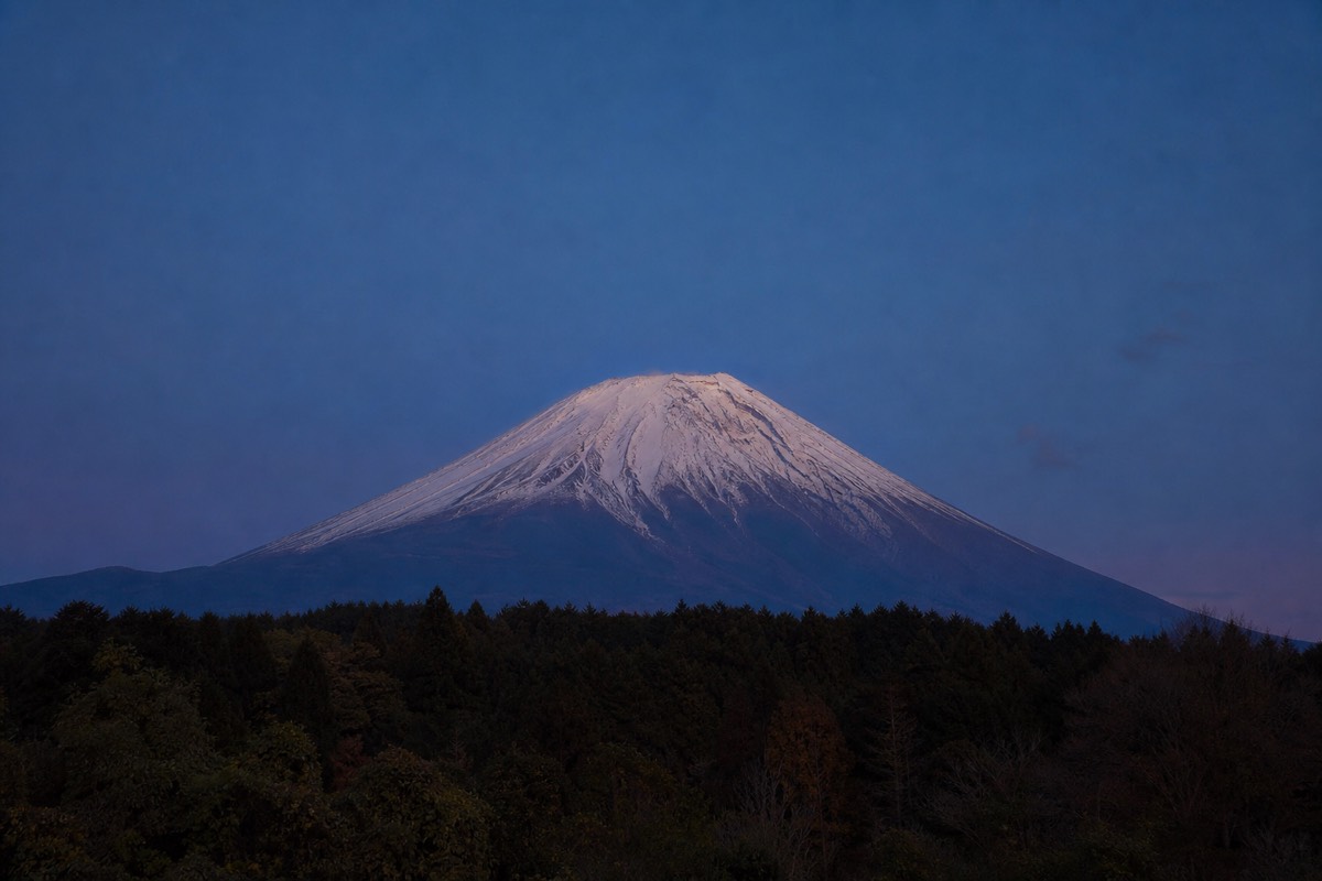
Aokigahara is the place name; Jukai is closer to a description that stuck. Search interest in "sea of trees" alone runs into the thousands per month, more than most of the forest's other search terms, which suggests a lot of people encounter the name before they encounter much else about the place. It deserves an honest explanation, because the actual mechanism behind the "sea" is one of the more interesting small pieces of volcanic geology on this side of Mt. Fuji.
The local nature walk connects the forest’s name with its roots, lava and living canopy. A lakeside or higher viewpoint is a separate experience.
3.5 hours: Geology commentary followed by a quieter stretch beneath the canopy. English guide; meet at NaturaBase opposite Fuji Lake Hotel and return there. Bottled water included; lunch extra.
Walk The Lava Forest With A Guide · Choose by time and starting pointWhat Does "Jukai" Actually Mean?
樹海 (jukai) combines 樹 (ju, "tree") and 海 (kai, "sea") into "sea of trees," a term Japanese uses generically for any dense, unbroken expanse of forest, not a name coined exclusively for this one location. Aokigahara is by far the most internationally known jukai, but the word itself predates and outlives that single association; other dense forests in Japan get called jukai too. What makes Aokigahara's use of the term especially apt, rather than just borrowed, is that its canopy genuinely produces the visual effect the word describes, which isn't true of every forest loosely called a "sea of trees."
Why Does The Forest Actually Look Like A Sea From Above?
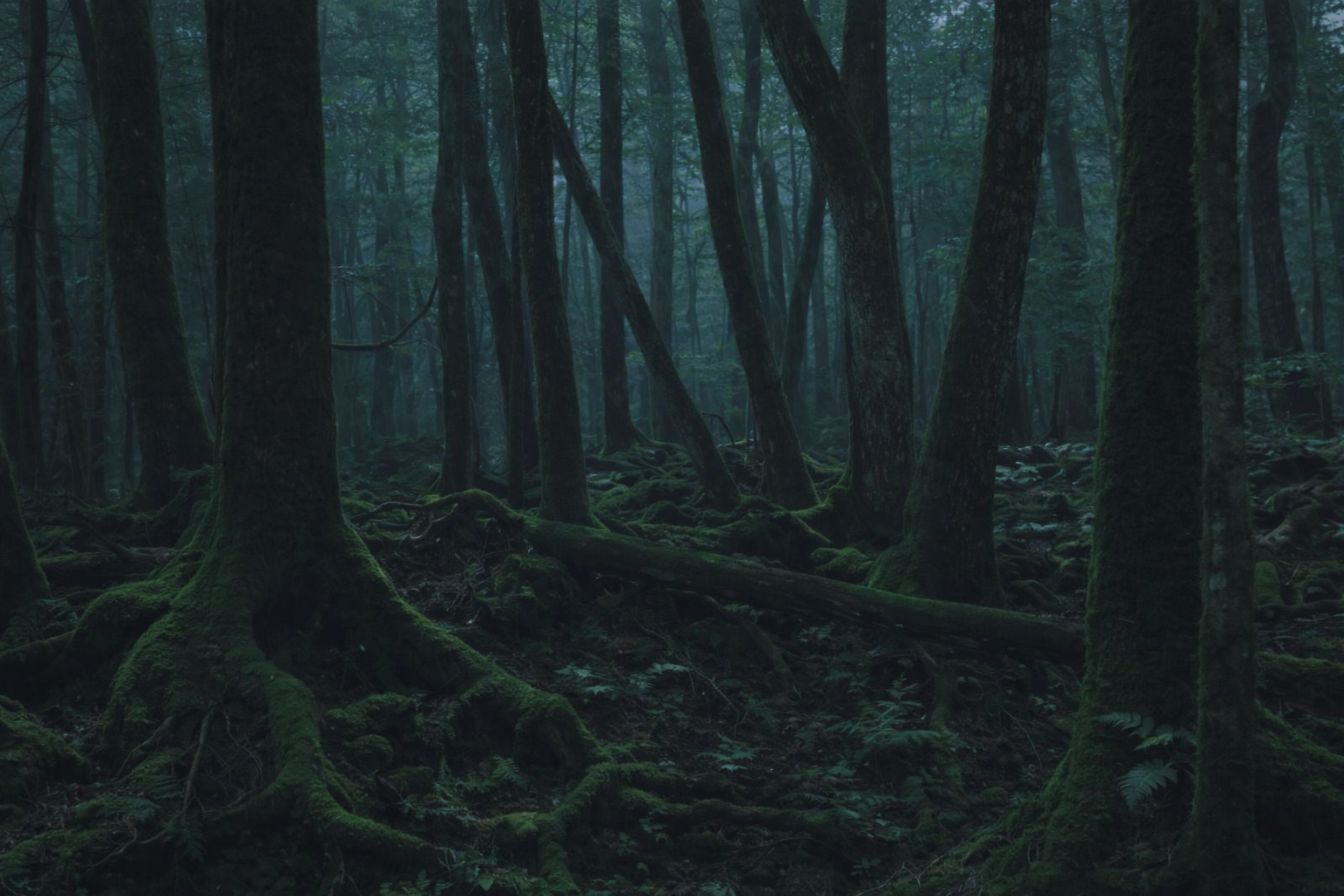
Because the canopy sits at a remarkably uniform height across the whole forest, so from an elevated vantage point like Mt. Fuji's slopes it reads as one continuous, rolling green surface rather than the ragged, mixed-height skyline of a typical mixed forest. That evenness is the visual trick: a normal forest canopy varies with each tree's age, species and growing conditions, breaking the skyline into bumps and gaps. Aokigahara's canopy doesn't do that, and the flatness is exactly what reads as a "sea" swelling gently under wind rather than a jagged treeline.
Why Did The Canopy End Up So Uniform In The First Place?
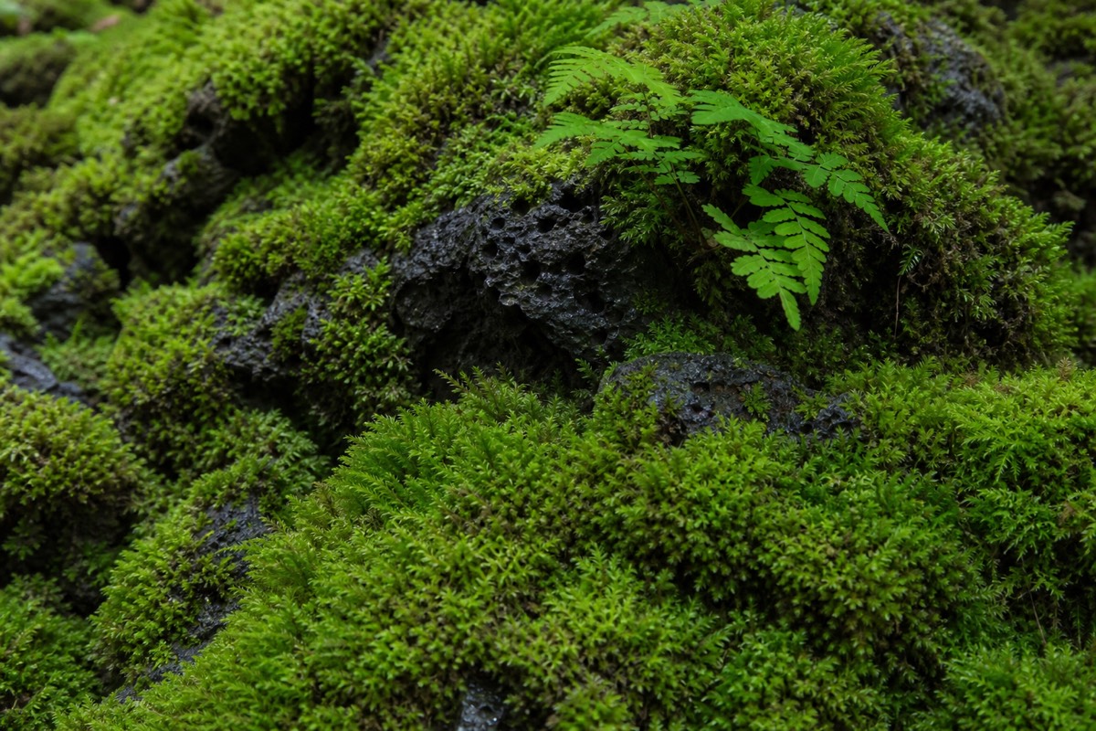
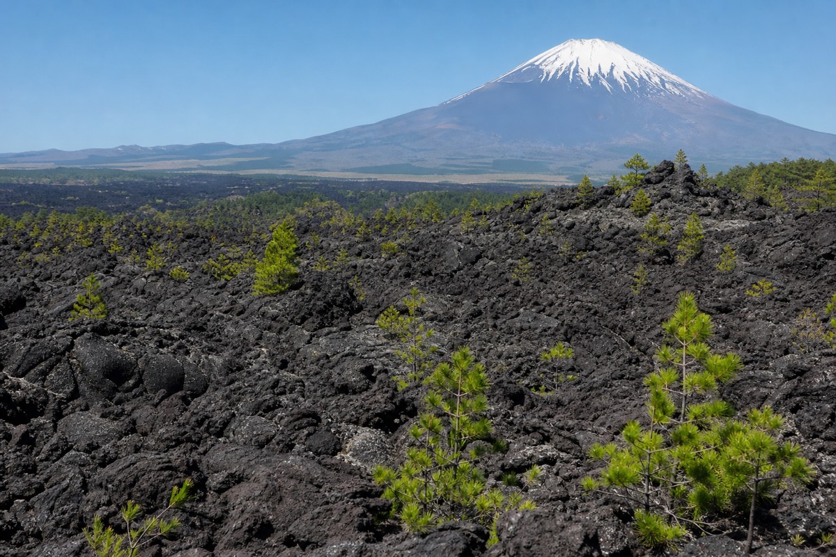
The uniformity traces directly to the lava rock underneath: with only a shallow layer of soil sitting on hardened lava, tree roots can't dig down, so once a tree gets tall enough that its shallow, sideways-spreading roots can no longer support the trunk, it falls over before it can tower over its neighbors. That's a genuinely elegant mechanical explanation, not a mystical one. The lava flow from Mt. Fuji's 864 CE eruption gave every tree in the area roughly the same starting substrate at roughly the same time, and the same structural ceiling on how tall any individual tree can safely grow. The result is a canopy that self-levels: trees that outgrow their root support don't survive to break the skyline, so the forest keeps trimming itself back to roughly one height.
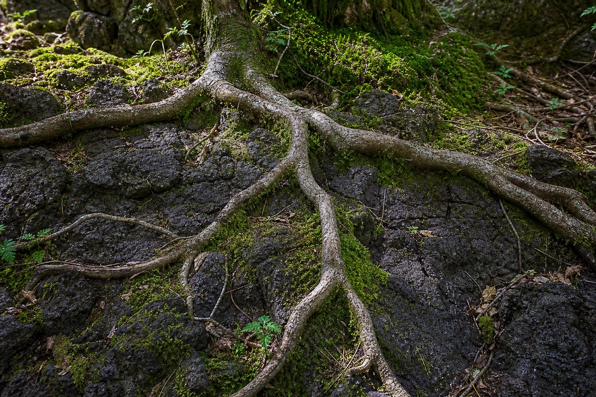
The short version: the forest looks like a sea because the ground underneath won't let any one tree grow tall enough to stand out. Roots that can't dig down can't anchor a tree past a certain height, so the whole canopy stays level by elimination, not by design.
What Trees Actually Make Up The "sea"?
Roughly 80% of the canopy is two conifer species, hinoki cypress and southern Japanese hemlock, with broadleaf trees like Japanese andromeda, hollies, Fuji cherries and maples filling in the rest. The dominance of just two conifer species is part of why the canopy reads as so visually consistent: it isn't a patchwork of many different tree shapes and colors competing for space, it's a forest where most of what you see, at eye level and from above, is the same handful of species repeating across 30 square kilometers of lava.
How Does The Forest's Age Connect To The "sea" Name?
Every tree in Aokigahara is, geologically speaking, growing on ground that only became available a bit over 1,100 years ago, when Mt. Fuji's 864 CE eruption buried the area in fresh lava; that shared, relatively recent starting point is part of why the forest still reads as one even, unbroken stand rather than a mix of old-growth giants and younger patches. A forest that colonized its ground gradually, in waves over centuries, tends to show that history in its canopy: taller old sections next to shorter younger ones. Aokigahara's canopy doesn't show that kind of patchwork nearly as clearly, because the whole area started from the same bare lava at close to the same time, and because the root-support ceiling described above keeps re-leveling it regardless of exact planting date.
What Does "Aokigahara" Itself Mean, Separate From "Jukai"?
Aokigahara (青木ヶ原) is the place name and a different piece of vocabulary from Jukai: 青木 (aoki) is usually read as "green" or "blue-green tree," and 原 (hara) means field, meadow or plain, so the name reads roughly as "green tree field" or "blue tree meadow." Put the two names together, as Japanese speakers often do, and "Aokigahara Jukai" reads as something like "the sea of trees at the blue-green tree meadow," a place name and a description stacked on top of each other. There's some genuine debate among sources over exactly how literally to read "aoki" here (a specific reference to a shrub species called aucuba versus a more general "green tree" reading), which is a minor linguistic detail rather than something that changes the practical meaning: either way, the name points at the same dense, green landscape.
Where Did The "meadow" (hara) Come From, If It's All Forest Now?
Before the 864 CE eruption, this area wasn't forest at all, it was open ground near a larger ancient lake called Senoumi, and the "hara" (field/meadow) in the name likely reflects the open, unforested lava field the eruption created before trees had time to establish on it. The same eruption that produced the lava caves also reshaped the area's lakes: it flowed into ancient Lake Senoumi and split it into two of today's Fuji Five Lakes, Lake Sai and Lake Shōji (a divide confirmed by the fact that both lakes, along with Lake Motosu, still sit at the same surface elevation, evidence they were once one body of water). So the name captures a real sequence: an eruption that first created bare, open volcanic field, on which a forest eventually grew thick enough to earn the second half of its name, "sea of trees."
Sea Of Trees, At A Glance
| Fact | Detail |
|---|---|
| Literal meaning of "Jukai" | 樹 (tree) + 海 (sea) = "sea of trees" |
| Literal meaning of "Aokigahara" | 青木 (green/blue-green tree) + 原 (field/meadow) = roughly "green tree meadow" |
| Is "Jukai" unique to Aokigahara? | No, it's a generic Japanese term for dense forest; Aokigahara is its best-known example |
| Why the canopy looks level | Shallow roots on lava rock can't support trees past a certain height, so the canopy self-levels |
| Dominant tree species | Hinoki cypress and southern Japanese hemlock, roughly 80% of the canopy |
| Underlying rock | Lava from Mt. Fuji's 864 CE Jōgan eruption |
Is "Jukai" The Forest's Official Name, Or Is "Aokigahara" Correct?
Both are correct and both are in everyday use: Aokigahara is the place name, Jukai is the descriptive name, and Japanese speakers use them interchangeably or together as "Aokigahara Jukai." Neither one is more official than the other; they simply do different jobs, one naming the location, the other describing what you see when you look at it. Official Japanese tourism materials tend to lead with "Aokigahara" and use "Sea of Trees" as the English gloss, which is the same convention this guide follows.
Why The Name Is Worth Understanding Before You Visit
Knowing what "Jukai" and "Aokigahara" actually mean turns a visit from looking at a dense forest into recognizing a specific, explainable landscape: a lava field, roughly 1,160 years old, that grew a canopy so level it earned a name built around the ocean rather than the woods. That's a genuinely different way to look at the tree line from a viewpoint on Mt. Fuji's slopes or from inside the forest itself, once you know the flatness isn't an accident of species or planting, it's a direct result of what's under the soil. The name isn't decorative. It's arguably the most accurate two-word geology lesson attached to any forest in Japan, translated straight from what you're standing on.
The three lava-tube caves scattered through the same lava field, the uneven root-and-rock trail underfoot, and the "sea" that gives the forest its name are all downstream of the same 864 CE eruption. Anyone curious about the mechanics behind the caves specifically, or the marked routes that connect them, will find both covered in more detail elsewhere on this site; this page exists to answer the narrower question of where the name itself comes from and why it fits.