How Aokigahara Forest Formed: Mount Fuji's Volcanic Geology
The forest floor in Aokigahara is rock first and soil a distant second, and every strange thing about how it feels to walk there traces back to one eruption. Japan's own tourism authority leads with this fact for a reason: the geology explains the roots, the ground, the silence and the caves better than anything else about the place.
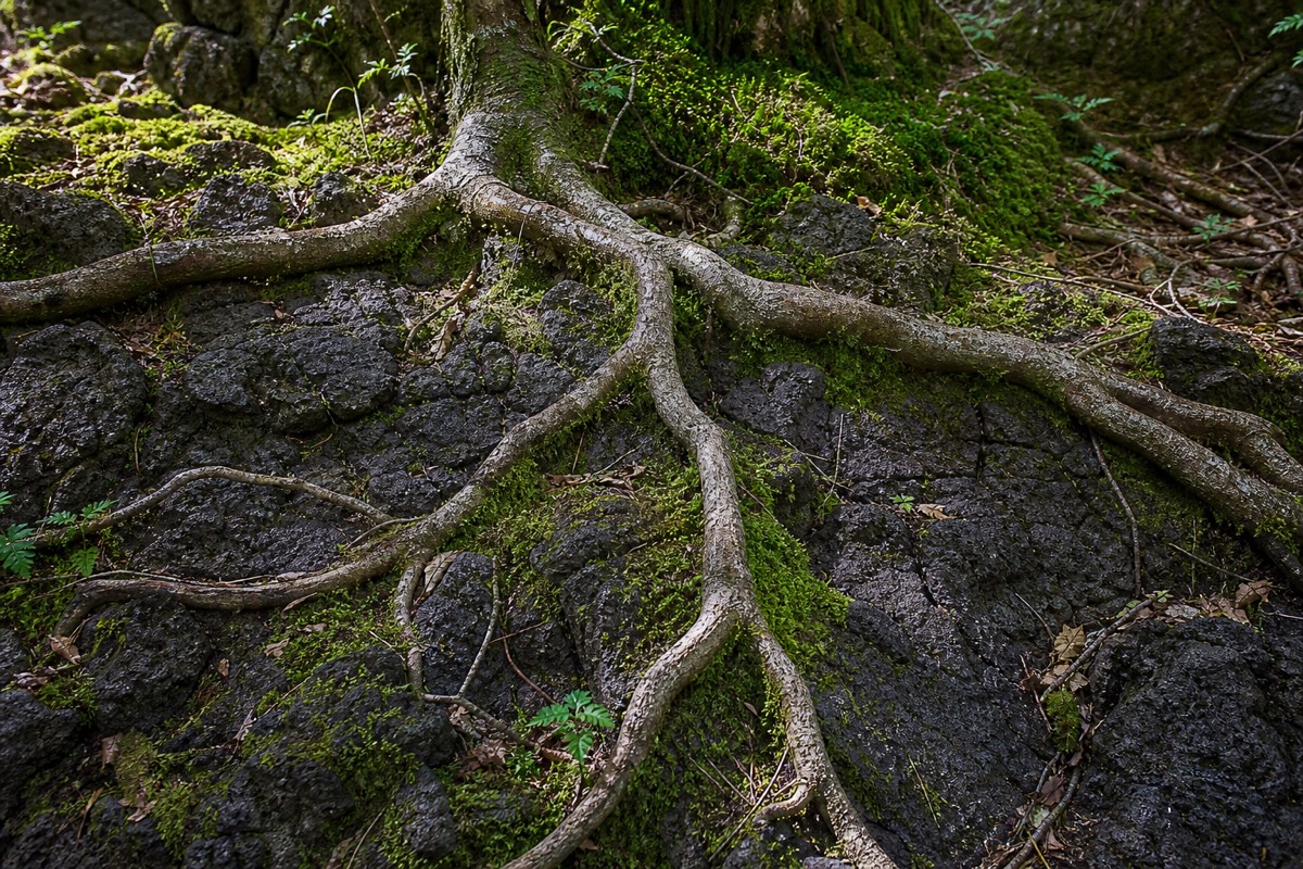
Most forests grow on soil that took millennia to build up from weathered rock and decayed plant matter. Aokigahara mostly didn't have that luxury. It grew directly on top of a lava flow, on a substrate that was bare volcanic rock within living memory of when the eruption stopped, geologically speaking. That single fact, more than folklore or reputation, explains the way the forest actually looks and feels underfoot.
An equipped cave excursion takes the lava-tube story underground. Choose the nature walk instead when roots, ecology and the forest floor interest you most.
3 hours: A guided cave expedition with helmet, overalls, gloves and headlight supplied. English guide and local pickup options at Kawaguchiko Station or selected area hotels; returns to the meeting point. Food and travel to the area are extra.
Explore The Cave With Equipment Included · Choose by time and starting pointAokigahara's geology, at a glance
Figures compiled from the site's own published research (864 CE eruption date, 30 km² forest footprint) and current JMA-sourced reporting on Mt. Fuji's volcanic alert status as of 2026.
How Did Aokigahara Forest Form?
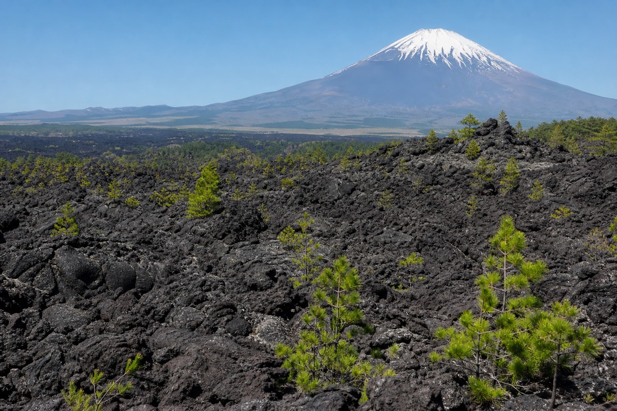
Aokigahara grew on the hardened lava field left by Mt. Fuji's Jōgan-era eruption in 864 CE, which buried the northwestern base of the mountain and, over the following centuries, became the substrate that today's 30-square-kilometer forest colonized. Japan's own national tourism organization leads with this fact when introducing the forest, and it's the single most useful thing to know before anything else: this isn't an old-growth forest that happens to sit near a volcano, it's a forest that exists specifically because a volcano created the ground it's standing on.
What Is A Lava Tube, And How Does One Form?
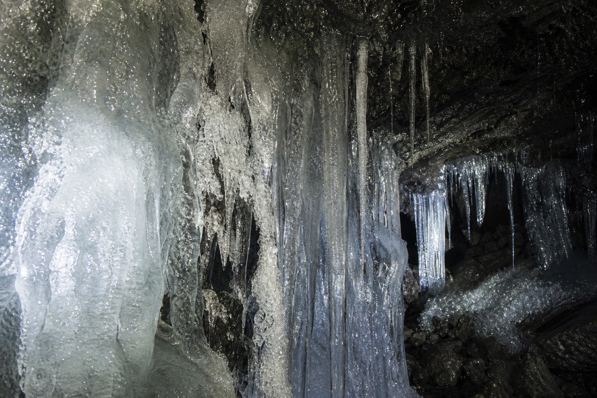
A lava tube forms when the surface of a flowing lava stream cools and hardens into a solid crust while the molten rock underneath keeps moving; once the eruption feeding it stops, the still-liquid interior drains away and leaves a hollow tunnel behind. That mechanism is exactly what produced the three tourist caves at Mt. Fuji's northern foot, Narusawa Ice Cave, Fugaku Wind Cave and the Lake Sai (Saiko) Bat Cave, each a separate hollow channel from the same broader volcanic event. The tube's thick rock walls, once formed, act as natural insulation, which is part of why the caves hold steady, distinct temperatures (near-freezing in Narusawa's case, a milder few degrees in the others) regardless of what the weather is doing outside.
Why Do The Tree Roots Spread Sideways Instead Of Digging Down?
Because there's solid rock under a thin layer of soil, so roots that would normally grow downward simply can't; instead they spread across the surface of the lava, sometimes rising above ground level entirely and wrapping over exposed rock in the gnarled, humped shapes the forest is known for. This is one of the forest's own already-documented characteristics, and it isn't a minor cosmetic detail. It shapes the whole walking experience: the ground rises and dips unpredictably underfoot, exposed roots create trip hazards even on the marked trail, and the same shallow-root limitation is directly responsible for why the forest's canopy stays at such a uniform height (a tree that outgrows what its sideways roots can support simply falls before it towers over its neighbors).
What Did This Area Look Like Before The Eruption?
Before 864 CE, the land where Aokigahara now stands wasn't forest at all: it sat near a single, larger ancient lake known as Senoumi, which the eruption's lava flow physically divided into two of today's Fuji Five Lakes, Lake Sai and Lake Shōji. The eruption began at a vent on Mt. Fuji's northwest flank and sent lava into the lake, and the split it caused is still measurable today: Lake Sai, Lake Shōji and Lake Motosu all sit at the same surface elevation, which is exactly what you'd expect if they used to be one connected body of water before a lava flow cut between them. Aokigahara grew directly on the new ground that same flow created, which means the forest and two of the Fuji Five Lakes share a single origin event.
How Does Bare Lava Rock Turn Into A Forest?
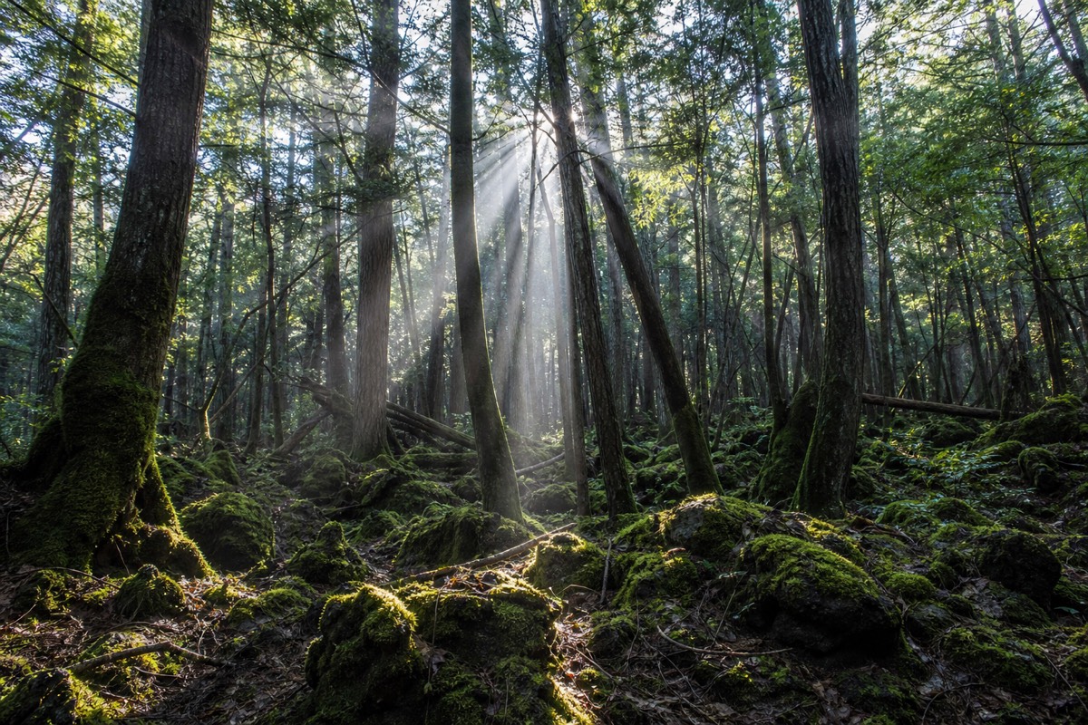
Through a slow, well-understood ecological process called primary succession: lichens and mosses colonize bare rock first, gradually breaking it down and building a thin layer of organic material, which hardier pioneer plants and eventually trees can root into. This is the same general process that turns bare rock into forest anywhere in the world after a lava flow, a landslide, or a retreating glacier, but it runs on a genuinely long timescale, because building even a thin soil layer from scratch takes far longer than growing on soil that already exists. Aokigahara is a live example of this process at a relatively early stage: the soil layer over the 864 CE lava is still thin enough, well over a millennium later, that tree roots can't penetrate it and have to spread sideways instead, which is the same root behavior described above and the same one driving the forest's unusually uniform canopy.
| Stage | What happens |
|---|---|
| Bare lava (right after 864 CE) | Solid volcanic rock, no soil, no plant life |
| Lichen and moss colonization | First organisms able to grow directly on rock; begin breaking it down |
| Thin organic soil layer forms | Slow accumulation of broken-down rock and decayed plant matter |
| Pioneer trees establish | Roots forced to spread sideways across the shallow soil, not down into rock |
| Today (~1,160 years later) | Dense, uniform-height forest; soil still thin enough to shape root growth |
How Old Is The Forest, Really?
The eruption that created the ground happened roughly 1,160 years ago as of 2026, but that isn't quite the same as saying the forest itself is 1,160 years old, since bare lava rock takes time to gather enough organic material before trees can establish at all. The eruption date marks when the substrate became available, not the exact moment the forest as it now stands finished forming. Either way, by old-growth forest standards elsewhere in the world, some of which have root systems and canopy structures dating back many thousands of years, Aokigahara is a comparatively young forest sitting on comparatively young rock, which is part of what makes its already-dense, already-uniform canopy a genuinely interesting fast case study in forest ecology on hard volcanic substrate.
Is The Forest Still Changing Today?
Ecologically, yes: primary succession is an ongoing, multi-century process, and Aokigahara's thin soil layer and shallow root systems suggest a forest that is still relatively early in that process compared with old-growth forests growing on far older, deeper soils. That doesn't mean visible change year to year, forests on this kind of timescale shift slowly, but it does mean the specific conditions that define a visit today (the uneven rock-and-root floor, the level canopy) are a snapshot of an ecosystem still working out its relationship with the volcanic rock underneath it, not a finished, static state.
Is Mount Fuji Still Volcanically Active Today?
Yes, officially: Mount Fuji is classified as an active volcano, and Japan's Meteorological Agency (JMA) rates it at Alert Level 1, "normal," as of 2026, meaning no unusual seismicity, ground deformation or gas emissions are currently being detected. Its last eruption was the Hōei event of 1707 to 1708, more than three centuries ago, so "active" here doesn't mean anything is imminent; it means the mountain remains a monitored volcanic system rather than an extinct one. JMA and university research teams track it continuously with seismometers, GPS ground-deformation sensors and gas monitoring, and volcanologists generally expect weeks to months of precursory signals before any major eruption, which is why current guidance treats the area, including the forest and its caves, as safe for normal visits.
| Question | Current answer (2026) |
|---|---|
| Is Mt. Fuji classified as active or extinct? | Active volcano |
| Current JMA alert level | Level 1, "Normal" |
| Last eruption | 1707–1708 (Hōei eruption) |
| Is it monitored? | Yes, continuously: seismometers, GPS deformation sensors, gas monitoring |
| Detected unusual activity as of 2026? | None reported |
What The Geology Explains About Visiting Aokigahara
Once the lava flow, the shallow roots and the self-leveling canopy are on the table, most of what stands out about Aokigahara stops needing any explanation beyond geology. The uneven ground is lava rock wearing a thin disguise of soil and root. The uniform, sea-like canopy is trees that structurally can't outgrow their neighbors. The caves are the same eruption, hollowed out rather than solidified. None of it needs embellishing to be genuinely interesting; it's one of the more legible pieces of volcanic geology you can walk through in a single afternoon.