Aokigahara Forest Hiking Trails & Difficulty Guide
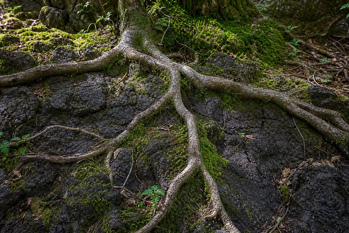
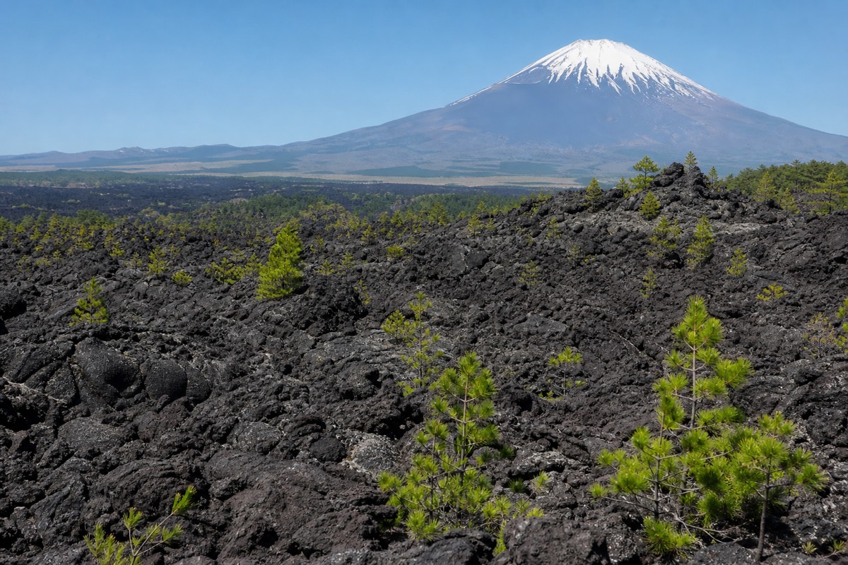
The ground underfoot in Aokigahara is the whole story: hardened lava wrapped in tree roots that never found soil to dig into, so the trail rises and dips in a way flat elevation maps don't capture. This guide covers the marked routes that actually exist, how long they take, what shoes you need, and who can realistically walk them.
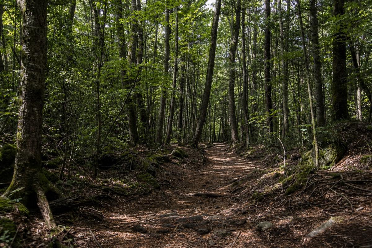
Search for "Aokigahara hiking trails" and you'll find a small but real cluster of people asking a fair question: is this forest actually walkable on defined paths, or is it the trail-less maze its reputation suggests? The honest answer sits in between. The parts of Aokigahara that tourists visit are threaded by a real, named, officially maintained trail, and the rest of the forest is intentionally left without one. That distinction is the whole guide.
The guided nature walk adds interpretation and pacing to a local outing. Confirm the route’s uneven-ground demands before booking for your party.
3.5 hours: Geology commentary followed by a quieter stretch beneath the canopy. English guide; meet at NaturaBase opposite Fuji Lake Hotel and return there. Bottled water included; lunch extra.
Walk The Lava Forest With A Guide · Choose by time and starting pointDoes Aokigahara Have Marked Hiking Trails?
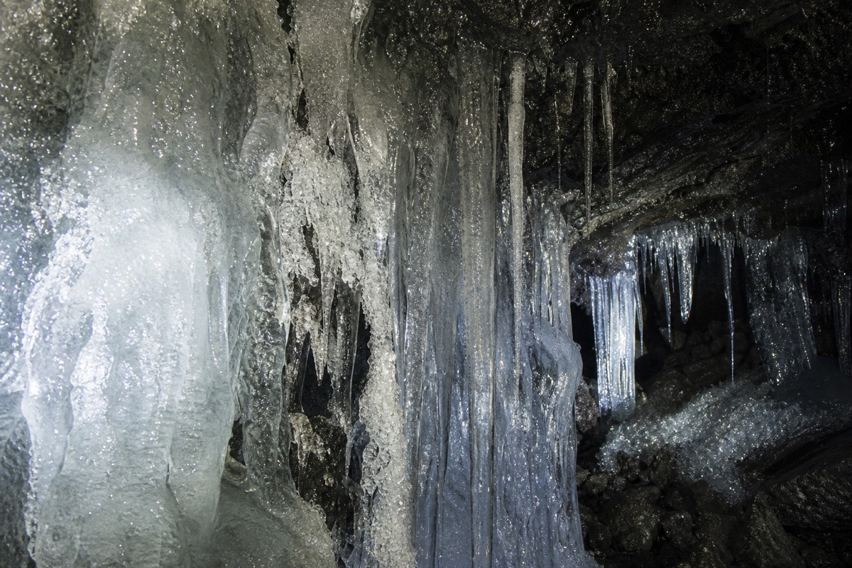
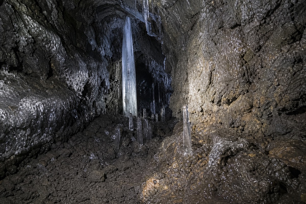
Yes. The Tōkai Nature Trail, a long-distance walking route that runs 1,697 kilometers across 11 prefectures, threads through the Aokigahara area beside Route 139, linking Fugaku Wind Cave and Narusawa Ice Cave with a marked, walkable path. This is not a local footpath invented for tourists; it's a segment of a national trail system, officially maintained and signed. Beyond this route and the short loop paths around the visitor centers at each cave, the interior of the forest is deliberately left unmarked, which is exactly why every sign at the entrances tells you to stay on the path. The trail network you can actually hike is real and mapped; the rest of the forest simply isn't meant to be a trail system at all.
How Hard Is Hiking In Aokigahara?
Easy to moderate on the marked cave-to-cave route: mostly flat in elevation but consistently uneven underfoot, since the trail crosses hardened lava rock wrapped in exposed tree roots rather than open soil. There's no steep climbing on the standard route between the caves, but you will be watching your footing constantly rather than striding out, because roots rise above the surface in humps and the volcanic rock beneath is jagged where it shows through. It's a walk that tires your ankles and attention more than your lungs. For hikers who want elevation and a view, the Tōkai Nature Trail continues beyond the forest from the Kōyō-dai parking area up toward the Mt. Ashiwada ridge, climbing above the treeline for panoramic views of Fuji, the Fuji Five Lakes and the Southern Alps; that extension is a genuinely different, harder hike than the flat cave-to-cave stretch.
How Long Do The Trails Take?
The core Bat Cave to Narusawa Ice Cave stretch runs about 3.2 miles and takes roughly 1 to 1.5 hours of walking; including stops at both caves, the fuller Saiko Nature Center to Michi-no-Eki Narusawa route takes about 3 hours. Individual segments between points of interest tend to run 20 to 60 minutes each, which is why most visitors treat the day as a series of short walks with cave breaks rather than one continuous hike. The Mt. Ashiwada ridge extension adds real hours on top of that and is a separate undertaking from the standard visit.
| Segment | Approx. distance / time | Difficulty |
|---|---|---|
| Saiko Nature Center to Bat Cave | Short walk, info point at start | Easy |
| Bat Cave to Narusawa Ice Cave (via the Tōkai Nature Trail) | ~3.2 miles / 1–1.5 hrs | Easy to moderate, uneven ground |
| Full loop with cave stops, Saiko Nature Center to Michi-no-Eki Narusawa | ~3 hours total | Easy to moderate |
| Kōyō-dai to Mt. Ashiwada ridge extension | Several additional hours | Moderate to strenuous; elevation gain, above the treeline |
What Shoes And Gear Do You Actually Need?
Sturdy, closed-toe hiking shoes with real grip are the one non-negotiable item, because the trail's uneven volcanic floor and twisted roots make trips easy in anything with a flat or slick sole. Beyond footwear, pack in layers: the forest sits at roughly 900 to 1,300 meters elevation, noticeably cooler than Kawaguchiko or Tokyo, and shade from the dense canopy keeps it cool even on hot days. A small flashlight or headlamp matters for the cave interiors, not the outdoor trail itself. Rain gear is worth carrying regardless of forecast, since the ground turns muddy and roots get slippery quickly after even a light shower.
| Item | Why it matters |
|---|---|
| Closed-toe shoes with grip | Uneven lava rock and exposed roots underfoot; sandals and smooth soles are a real trip hazard |
| Light jacket or fleece | Forest elevation runs cooler than nearby towns, even in summer |
| Headlamp or small flashlight | Needed inside the lava-tube caves, not the outdoor trail |
| Rain layer | Roots and rock get slick fast after rain |
| Cash in small yen notes | Cave entrance fees and parking are typically cash-based |
Can Kids Or Seniors Manage The Trails?
Yes, on the marked cave-to-cave route, which is short, broken into manageable segments, and graded easy to moderate rather than strenuous; the main obstacle is uneven footing, not distance or elevation. Most operators find the standard route workable for children around 6 to 7 and up who can comfortably walk for an hour or two on uneven ground, and for older travelers who are steady on their feet but don't want a strenuous climb. The uneven surface, not the length, is what determines whether a given hiker will find it easy or tiring: younger children may need a hand over the rootier stretches, and anyone with balance or mobility concerns should treat "easy to moderate" as a real caution, not just a formality. The Mt. Ashiwada ridge extension is a different proposition and not something to plan around young kids or anyone unsteady on steep ground.
Guided Or Self-guided: What Changes On The Trail Itself
On the marked route specifically, a guide's value is route-finding and pacing between three separate cave sites, not access, since the tourist trail itself is open, signed and walkable independently. Cell service thins out in stretches of the forest even on the marked path, and the segmented nature of the route (walk, cave, walk, cave) means a guide who already knows the timing between stops keeps the day moving instead of you working it out at each junction. Whether a guide is worth it for your overall visit, beyond just the trail logistics, is a bigger question than this page covers; here the point is narrower: the trail itself doesn't require a guide, but it rewards having one if you're trying to see more than one cave in a day without wasted time.
What Season Is Best For The Trails?
Spring and autumn give the most comfortable walking conditions, cool but not cold, with the ground less waterlogged than the rainy early-summer stretch; winter adds cold and, at the Bat Cave specifically, a seasonal closure from December 1 to March 19. Summer is walkable and the forest's shade helps against the heat, but expect more moisture underfoot from seasonal rain, and the deep canopy that keeps you cool in July is the same canopy that keeps roots and rock damp for longer after it rains.
How Does The Trail Connect To The Wider Fuji Five Lakes Area?
The Tōkai Nature Trail doesn't stop at Aokigahara's edges; it runs along the northern shore of the Fuji Five Lakes area more broadly, connecting the forest to the same corridor of trail that touches Lake Kawaguchi, Lake Sai and the land around Mt. Ashiwada. That matters practically because Aokigahara isn't an isolated walking loop, it's one segment of a much longer regional trail system, which is part of why the route through the forest feels genuinely maintained rather than informally worn in. If you're staying anywhere in the Fuji Five Lakes towns, the same trail system that threads through the forest is, in principle, walkable in both directions well beyond the caves, though most visitors have no reason to go further than the cave-to-cave stretch and the optional ridge extension.
What Happens If You Leave The Marked Trail?
Navigation gets genuinely difficult, fast: past the marked route there are no landmarks, cell service drops out in stretches, and the dense, uniform tree canopy blocks the kind of sightlines you'd normally use to reorient yourself. This isn't a dramatic warning, it's a description of the terrain. Aokigahara's canopy is unusually even in height (a separate, purely botanical quirk of how the forest grows on shallow volcanic soil), which removes an obvious landmark, and the volcanic rock floor looks similar in every direction once you're a short distance off the path. Every entrance sign says the same thing for this reason, and it's the single most practical piece of advice in this whole guide: the marked trail is short, safe and well signed, and there's no upside to leaving it.
Is The Trail Accessible For Strollers Or Wheelchairs?
Not realistically. The uneven volcanic surface and exposed roots that define the whole trail make it difficult even for standard jogging strollers, let alone wheelchairs, and there's no paved alternative route through the forest itself. The visitor centers and immediate cave entrance areas are more level and manageable, so a shorter, cave-focused visit without the connecting walk between them is a more realistic option for anyone with mobility equipment, but the trail proper should be treated as a hiking surface, not a paved path.
How Does The Difficulty Compare To Other Mt. Fuji-area Hikes?
Aokigahara's marked route is far easier than climbing Mt. Fuji itself and easier than most alpine trails around the mountain's higher stations, closer in exertion to a longer walk through a hilly county park than to a mountain hike. The elevation gain on the standard cave-to-cave stretch is minimal; what makes it feel more demanding than a flat park path is purely the footing, not the climb. That comparison flips for the optional Kōyō-dai to Mt. Ashiwada ridge extension, which does involve real elevation gain above the treeline and belongs in a different difficulty category from the rest of this guide.
Staying On The Marked Route
Every sign at Aokigahara's entrances says the same thing for the same practical reason: past the marked route, the terrain gives you no landmarks, cell service drops out, and the lava-rock floor looks the same in every direction under an unbroken canopy. That's not a warning about the trail itself, which is safe, short, and well signed. It's the reason the trail exists as a defined route in the first place, and the reason staying on it is the whole point rather than a suggestion.